Chasing the Snowline
12th March 2024
Greater amounts of new snow fell yesterday evening and overnight than was expected and as a consequence it looked quite wintry on the mountains this morning. However, the snow fell in light to moderate SE winds so it is an overall covering of soft moist snow lying above 700m. but quickly thawing as the freezing level climbed above the summits through the morning. Otherwise, the existing snowpack remains largely unchanged; well consolidated and stable throughout.
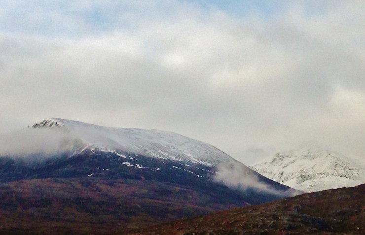 (Above) The north top of Beinn Liath Mhor Fannaich showing a definite fresh snowline at 700m. on its north aspect. Sgurr Mor in the right background looking very wintry first thing this morning.
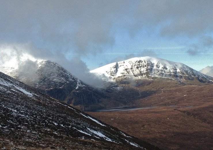 (Above) The snowy NE aspect of Meall a’ Chrasgaidh above Loch a’Mhadhaidh with Carn na Criche on the left. There was a significant rise in temperature by mid morning and I felt like I was following the rising snowline as the new snow quickly thawed.
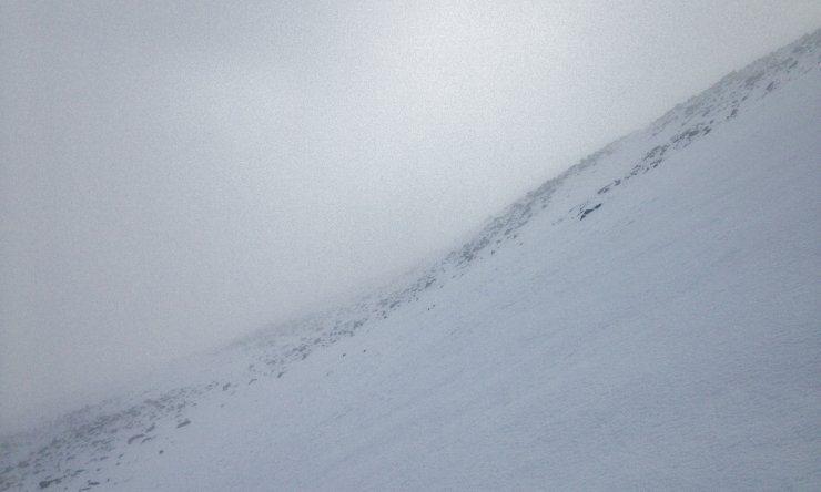 (Above) By late morning, thick cloud engulfed the summits spoiling the views. Large areas of firm old snow exist on N to E aspects mainly above 800m. in the Fannaichs, being the more inland mountains of our forecast area. The covering of new snow was around 10cm deep on sheltered NW to N aspects.
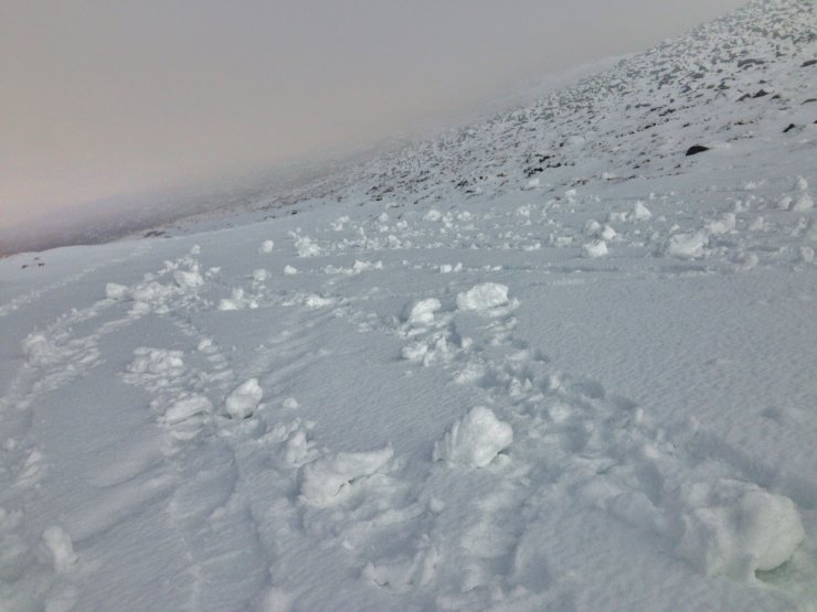 (Above) As the new snow thawed, it became moist and ‘sticky’, perfect for roller ball activity. This is a sign of potential wet snow instability and would be notable in deeper accumulations on steep terrain. However, in current conditions of a shallow snow covering, it is not an avalanche hazard, although balling-up of crampons could be an issue, particularly if worn on terrain where the soft moist snow overlies the firm older snowpack.
Comments on this post
Got something to say? Leave a comment