A Fine End to 2023
31st December 2023
Schoolboy error! With a generally ESE wind, cloud hugged the high tops of the mountains in the NE of our forecast area, only clearing early afternoon. Whereas, it looked much brighter towards the coast all day. Of course, I was observing in the Fannaichs in the NE of our area! However, it was a good wintry day out with an overall shallow covering of snow, mostly above 500m. Localised areas of fresh windslab have accumulated in wind sheltered terrain, affecting steep W to N aspects above 750m. Otherwise, the snowpack has generally good stability.
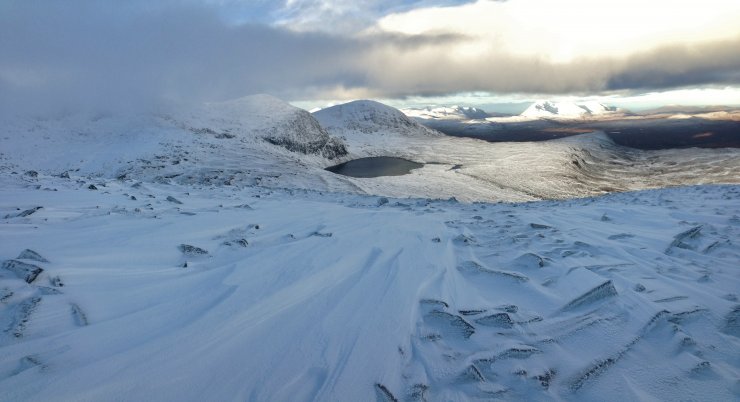
(Above) Looking from Beinn Liath Mhor Fannaich to Carn na Criche and Meall a’ Chrasgaidh and An Teallach in the background. Note the wind packed snow tails in the foreground, running in a SE-NW direction. Rime is building on the rocks.
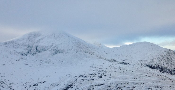
(Above) The NE faces of Sgurr Mor (1110m) on the left and Carn na Criche on the right. Looking very snowy, but only a relatively shallow snow cover. No cornices were observed today.
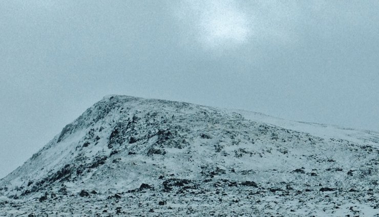
(Above) The classic snow distribution on the north top of Beinn Liath Mhor Fannaich. The left, NE face, has been scoured and fresh windslab has accumulated in the sheltered terrain on the right with a NW aspect.
(Above) Of course the summits cleared early afternoon as I was walking off the hill!

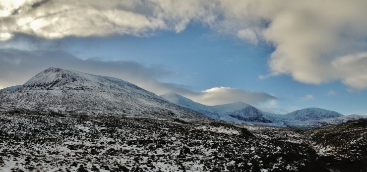
(Above) An Teallach on the right with Beinn a’ Chlaidheimh and Beinn Dearg Mor on the left. Less summit cloud on the more coastal mountains today.
Comments on this post
Got something to say? Leave a comment


