Big Vistas
4th March 2020
It was basically a re-run of yesterday; cold, generally dry and clear in the morning with some summit cloud and cloudier with scattered showers in the afternoon, wintry above 600m. The wind was stronger today than yesterday with redistribution of lying snow onto Northerly aspects, building localised areas of fresh unstable windslab. Weaknesses persist in areas of older windslab, mainly North to East aspects above 750m. Otherwise, the general snowpack is consolidating well and icy in exposed places at higher elevations.
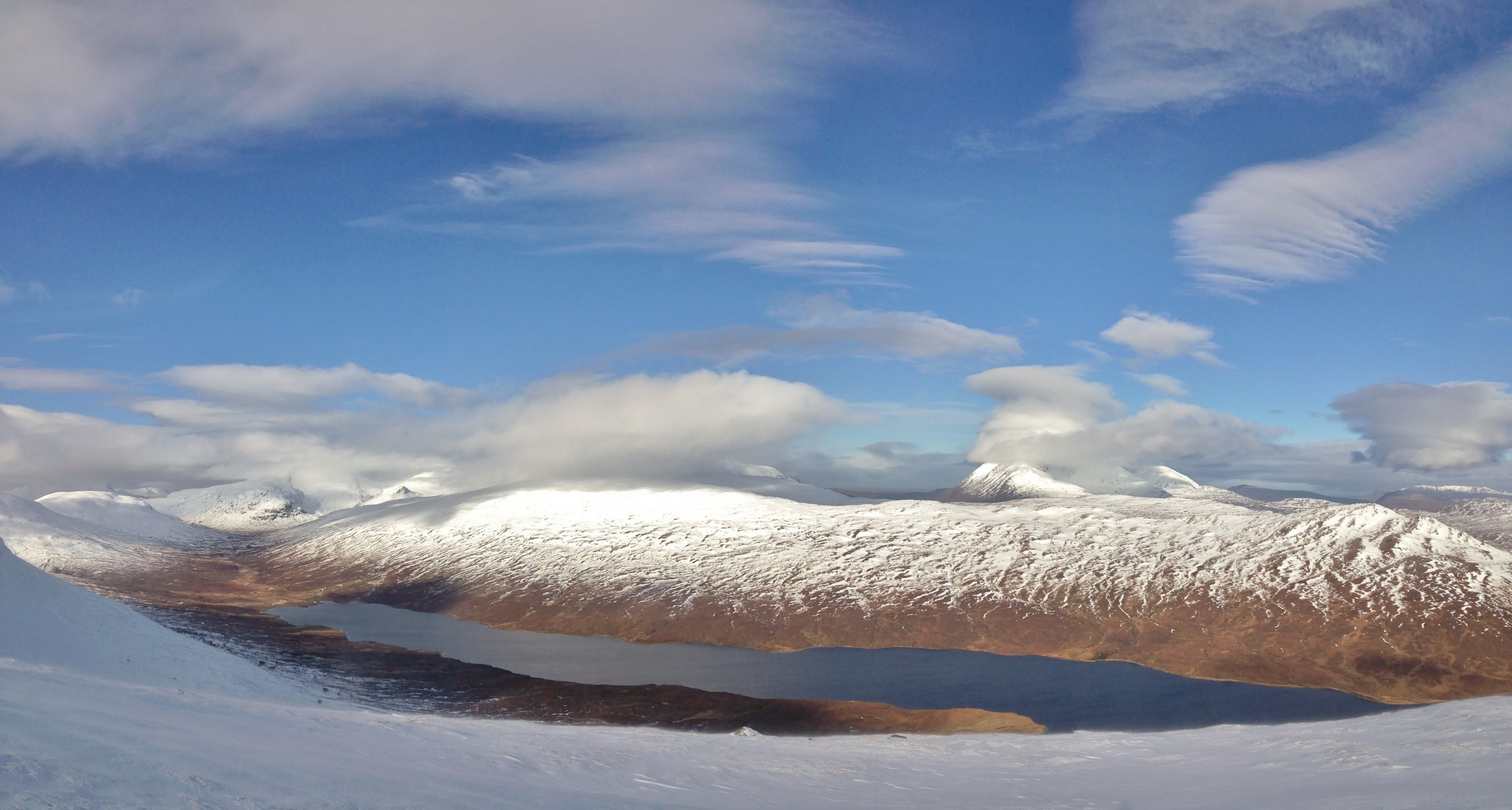
Loch a’ Bhraoin on the northern edge of the Fannaich mountains, with the hills of the Great Wilderness on the left and An Teallach to the right. Lenticular and wave bar clouds building as the Southerly winds strengthened through the morning.

The way up onto the higher slopes of Druim Reidh leading to Toman Coinnich which lies between the Munros of Sgurr Breac and A’ Chailleach. Hard going breaking trail through the breakable crust at lower to mid height. Deep drifts and cornices of older snow on the skyline at around 600m.
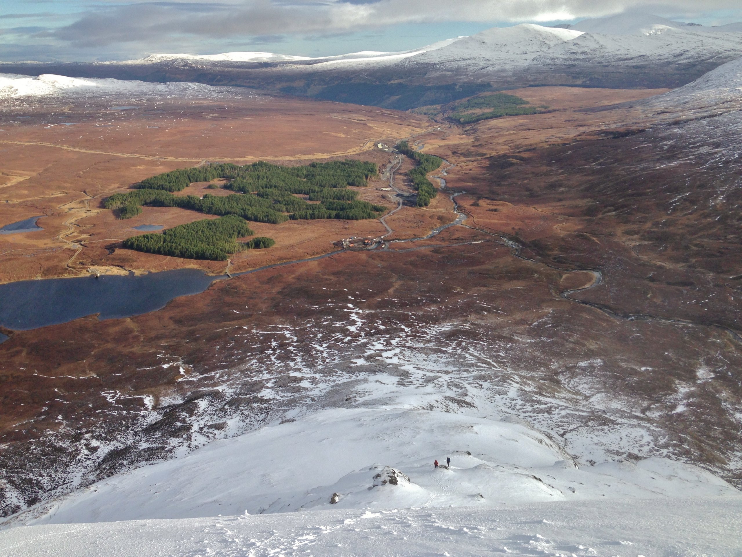
I was followed by two young lads up the shoulder, heading for Sgurr Breac. Funnily enough, they didn’t catch me up and every time I stopped, they seemed to stop also and what looked like, adjust their gaiters…? No, I’m being unfair. It was steep and hard going even to follow in tracks.
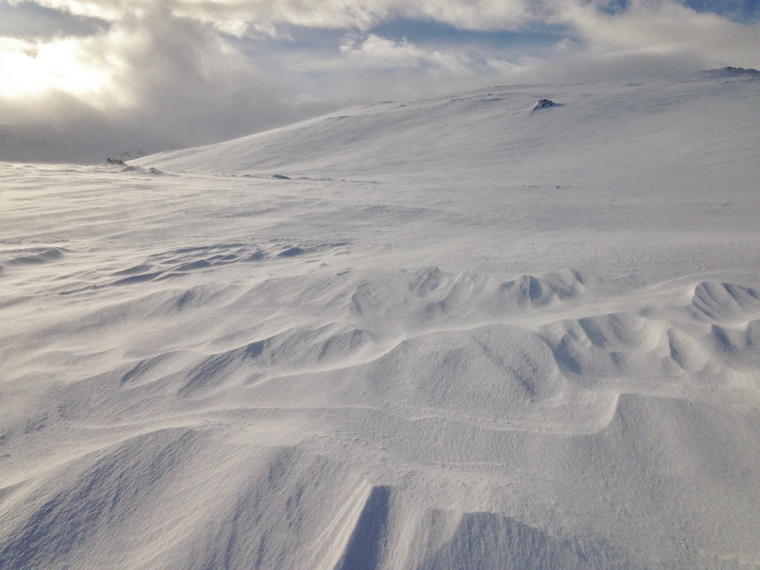
Sastrugi shapes in the snow! Wind blowing across this slope is eroding the soft snow and redistributing it onto lee aspects. The windspeed was around 20mph, perfect speed for transporting snow and cornice formation. The spindrift (transported snow) was no more than 15cm above ground level. The breakable crust was mostly weight bearing above 600m and pockets of fresh windslab were forming in wind sheltered locations.
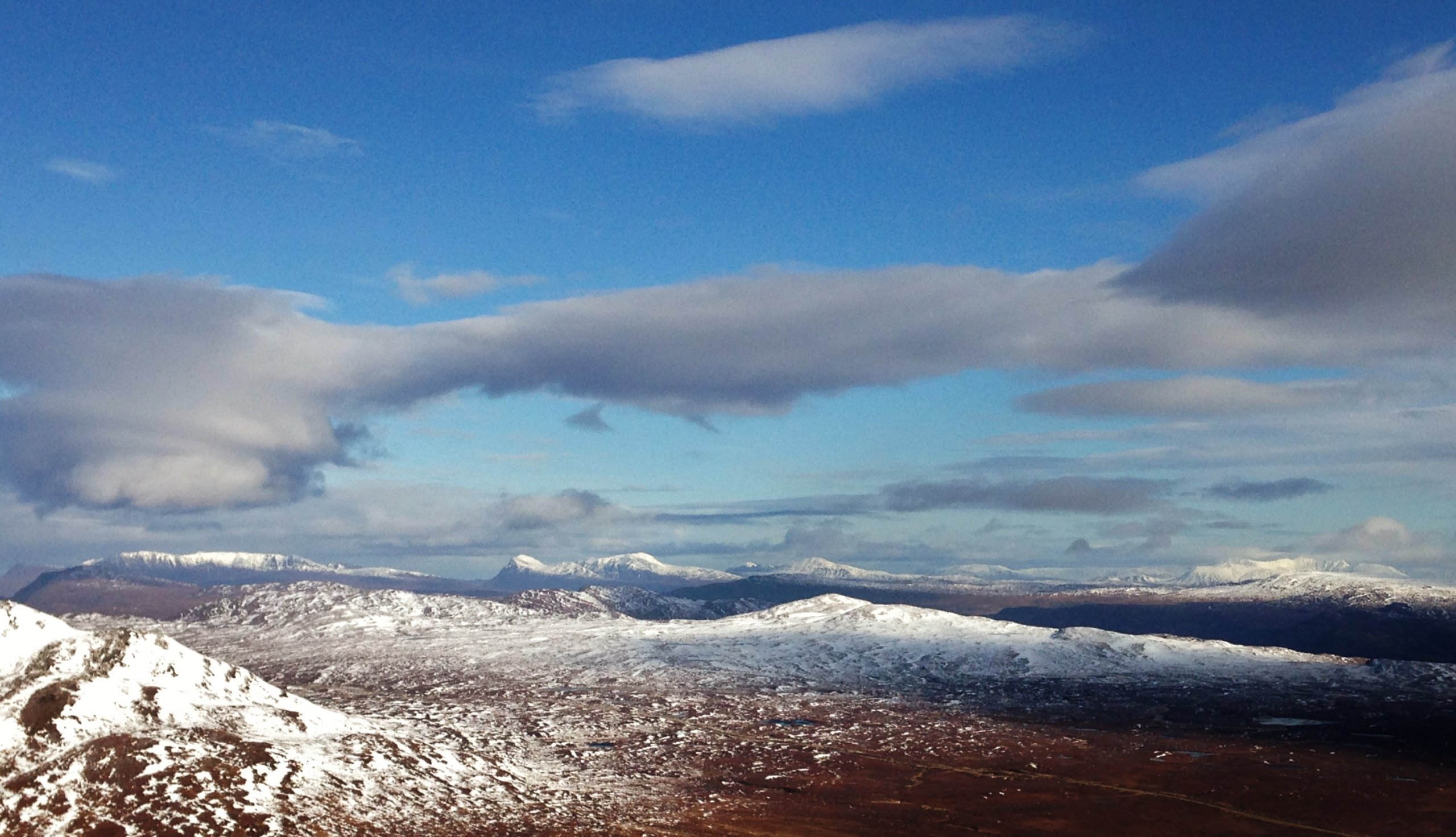
The big vista to the north. Very clear air so visibility was good. If you know your hills, I could see up to Arkle and Foinaven. Ben More Assynt on the right and the long ridge of Ben More Coigach on the left.
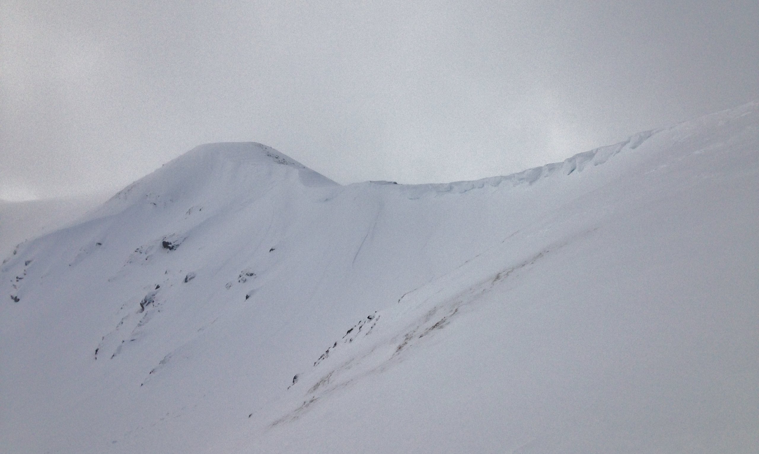
The site of today’s snowpack obs at around 800m on Druim Reidh. A cornice triggered slab avalanche was recorded last Saturday at this location after a short overnight thaw. The side wall of the avalanche is visible centre photo as a shadowed more or less vertical line descending from the corniced edge.
Comments on this post
Got something to say? Leave a comment


