Waves, Windchill and Watchers
2nd March 2025
A very windy day in the Fannaichs, mostly cloudy but dry. The mission was to cycle and walk into Sgurr Mor to check out the snow cover on the wind sheltered east face. It wasn’t a day to be on exposed summits! Sgurr Mor is the highest peak in the Torridon forecast area at 1110m.
The air temp was +1C at 860m in the coire, so there was a considerable windchill in the very strong SW wind during the cycle and approach. The limited snow cover is slowly thawing at most elevations, except for the highest summits. The patchy old snow is firm, whilst the most recent snow cover is moist and generally soft in all locations. Very little snow remains below 750 metres.
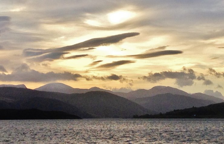
(Above) I knew it would be very windy in the mountains from the offset. The lenticular and wave bar clouds over the Beinn Dearg mountains were a sure sign.
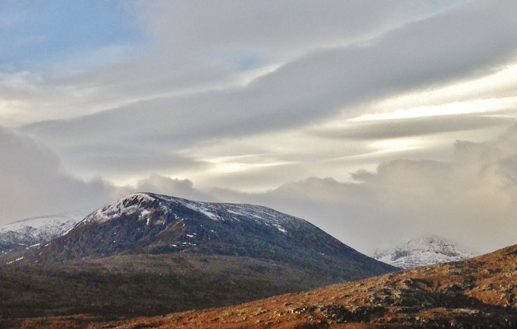
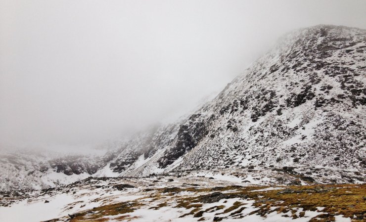
(Above) Similar cloud formations above Beinn Liath Mhor Fannaich. The east face and north ridge of Sgurr Mor is in the background right, largely obscured by low level cloud.
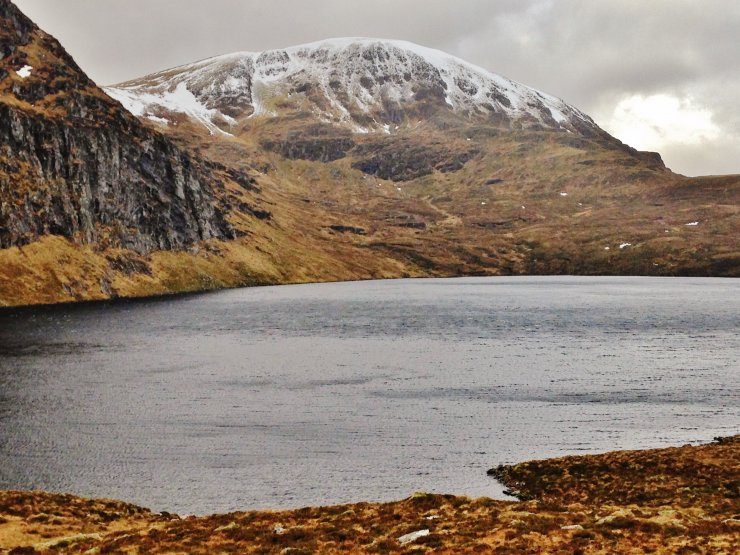
(Above) The NE aspects of Meall a’ Chragaidh (934m.) above Loch a’ Mhadaidh. Good fish in this deep loch, but hard to catch! Most of the snow on Meall a’ Chrasgaidh is old snow.
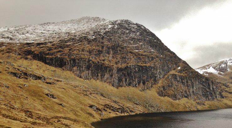
(Above) A thin cover of most recent snow on the summit of Carn na Criche, 961m. The crags above the loch sport a few good ice climbs – when in condition….
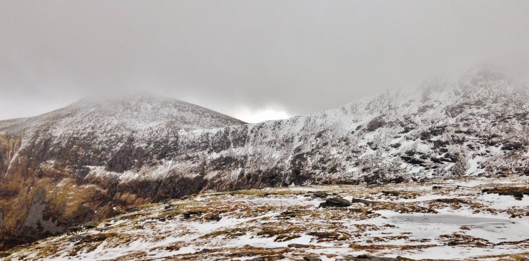
(Above) Snow cover on the east face of Sgurr Mor, with the start of north ridge on the right. I noted some rotten ice lingering at the start of the classic winter climb ‘Resurrection’.
(Above) Looking across to the NW aspects of Beinn Liath Mhor Fannaich, 954m.
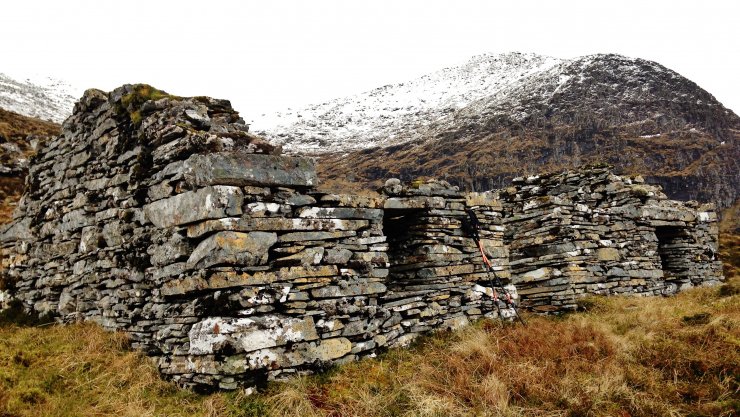
(Above) The ‘Watcher’s’ shieling. Back in the day, estates employed folk to keep an eye out for poachers who took cattle, deer and/or trout. They were known as Watchers. It would also be used as a summer dwelling (shieling) for cattle hearders. I have sheltered many a time in this ruin – a great spot for a cuppa and snack on a cold winter’s day!
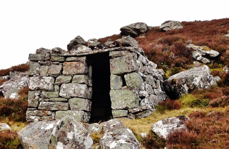
A ‘Howff’. The Fannaichs are criss-crossed with old stalkers paths, sometimes leading over high cols and ridges, but avoided the summits. Well constructed roofed shelters are dotted around these paths. My favourite one is just below 900m. on the ridge between Sgurr Mor and BLMF. This one is by a vehicle track, which would have been on a path pre 1950’s when the hydro schemes were built. However, it’s another good place for a sheltered brew!
Comments on this post
Got something to say? Leave a comment


Keith Horner
2nd March 2025 7:09 pm
Have used the howff below Sgurr Mor several times for a bit of shelter – it seems high for a watchers outlook but possibly the rustlers crossed that col? The local stone is perfect for producing large squared blocks which makes building easy and probably why these structures have remained relatively intact for so long…
torridonadmin
3rd March 2025 6:41 pm
Hi Keith. Thanks for your comment. I agree regarding the schist blocks that also fracture into slabs that can be used for roofing material. The stalker’s path that the ruin overlooks takes a rising traverse on the north shore of Loch a’ Mhadaidh to continue under the east aspects of Meall a’ Chrasgaidh up to the col between it and Carn na Criche. It is becoming less obvious over the years as it is little used and becoming overgrown with grass and heather. There is also a vague path that follows a low angled rake out of the Sgurr Mor coire onto the ridge between it and BLMF, joining the main path near the shelter I mentioned. Ponies are rarely used these days, substituted with Argo ATV’s.
torridonadmin
4th March 2025 6:16 pm
Agreed! A lost skill indeed. ATV’s are so aggressive and destructive in places where an inappropriate line is taken.
Keith Horner
3rd March 2025 7:18 pm
Sad to see the traditional stalkers tracks progressively falling out of use – they invariably follow the most practical route in gaining altitude with minimal effort through the path makers innate ability to judge gradient and alignment in often complex topography.